Understanding connected forestry equipment
Connected forestry equipment refers to machines equipped with sensors and wireless technology that transmit data in real time. These installations employ tools such as LiDAR scanners, cameras, and drones to observe, map, and monitor forests in real time as operations unfold. The key aspect is that all this equipment communicates with one another and with personnel back at base or out in the field, transmitting updates, sensor readings, and alerts. This constant stream of information allows employees to visualize operations, detect issues early, and intelligently intervene without having to halt equipment.
Real-time data exchange is central. When a harvester or forwarder captures data, like tree size or machine location, it can immediately broadcast that info to operators, managers, or even other machines. For instance, LiDAR systems on harvesters can now scan the forest, mapping how tall trees are and where there are gaps or dense spots. Operators can then alter the route or modify speed on new maps rather than trial and error. Cameras add another layer by monitoring plant wellbeing, identifying risks, or scanning barcodes on timber. There’s less need to pause and verify manually, which keeps things humming and eliminates downtime.
Connectivity does more than accelerate decisions. It assists in automating simple tasks. A nice example might be drones equipped with sensors buzzing over a forest to map change, monitor soil, or identify fire hazards. These drones can transmit live photos and information to the central system, reducing the requirement for on-site inspections. Robotics on the ground can trace predefined paths, apply pesticides, or sow with minimal human assistance. Humans remain in the loop, particularly for major decisions or when things go awry. This hybrid of automation and human oversight provides increased control and superior outcomes.
Signal problems can be a major obstacle. Forests obstruct wireless signals and therefore make it difficult to determine the location of machines or drones. LPWAN helps bridge those gaps by using less power and working over longer distances. However, dense forests or terrain still cause coverage holes. This impacts how efficiently machines can log their own locations or communicate with each other, so businesses need to select their network configurations thoughtfully.
Different sensor platforms are good for different jobs. LiDAR provides excellent 3D maps that are valuable for ecommerce planning and supply inventory. It is pricier and requires skilled personnel. Cameras are versatile and less expensive, but do not always perform well in low light or smoke-laden air. UAVs, or drones, can cover large areas quickly and carry more sensors than ever, but weather and signal loss are limiting. Robots can deal with challenging topography, but they require clear trails and contingency plans in case of malfunctions. Choosing the appropriate sensor and platform combination varies according to the size of the forest, objectives, and budget.
Key benefits of connected forestry equipment:
- Boosts real-time monitoring, reducing guesswork and manual checks
- Helps track forest health, growth, and resources accurately
- Cuts downtime by spotting issues and sending alerts early
- Makes planning and reporting more reliable with live data
- Allows smarter use of fuel, tools, and staff
- Provides a more secure work site by observing hazards and dangerous areas.
Key sensor technologies in forestry
Forestry has historically employed sensors to monitor and manage forests. The move to connected machinery now provides an unprecedented level of precision and speed for forestry. Sensors provide real-time data on terrain, trees, and equipment. These tools are now must-haves for companies eager to work smarter and slash waste.
GPS sensors track where machines are at all times. We put the latest locator equipment on both piloted and autonomous vehicles. Smart tech like AI needs to know the exact location. In clear open fields, GPS will indicate a location within 5 meters. In young forests, that drops to around 7 meters and up to 10 meters under dense cover. A few newer configurations can reach as low as 1.5 meters, but the actual precision depends on how dense the forest is and whether the signal is obstructed. For most tasks, this is sufficient, though it necessitates strategizing for periods when signals lapse.
LiDAR (Light Detection and Ranging) provides a 3D view of the terrain and trees. It operates by emitting light and detecting its reflection. These enable forestry crews to map terrain, measure tree heights, or identify changes. Thanks to recent advances in LiDAR, teams can now obtain crisper, speedier scans. Others are deploying hyperspectral data to scan vast areas. One team, for example, mapped 340 square kilometers with a ground sample distance of only 2 to 4 meters, repeatable a year later to track changes. By combining remote sensing data, such as from satellites or aircraft, with in-situ validation, forestry teams achieve a richer, more comprehensive view of forests.
Environmental sensors do more than track trees. They can track soil pH, moisture, and even air quality. A few new sensor variants use printed circuit boards (PCB) to check pH or other factors, which comes in handy when checking forest health or scouting where to plant new trees. Armed with these, teams can observe the forest’s response to change or stress.
Load sensors and fuel trackers are attached to forestry machinery. Load sensors measure the pressure or weight on a piece of equipment, assisting crews in identifying when a piece of equipment is being overutilized or misused. Fuel monitors indicate fuel consumption, allowing crews to improve planning and reduce waste. Both kinds keep the machines running smoothly and longer.
Telematics sensors are the conduit between the machine and the office. These monitor things like engine health, run hours, and service needs. By tracking this information, crews can identify minor problems before they escalate into major overhauls. This saves time and money.
| Sensor Type | Function | Benefit |
| GPS | Tracks machine location | Better navigation, AI use, work tracking |
| LiDAR | Maps land and trees in 3D | Sharp maps, change tracking, resource use |
| Environmental | Checks soil, air, and water | Forest health, stress spotting |
| Load | Measures force and weight on machines | Safer, longer use, less breakage |
| Fuel Monitoring | Watches fuel use | Lower waste, better planning |
| Telematics | Checks machine health and service | Fewer breakdowns, smart repairs |
Data-driven forest management
Data-driven forest management leverages connected sensors and digital tools to collect minute-by-minute information about forests. It enables managers to make informed decisions about optimal harvesting time, timber volume available, and measures to maintain forests on a sustainable basis. Sensors monitor soil moisture, air temperature, and tree growth on a daily basis. Drones and remote cameras add even more layers of real-time data, so there are fewer holes and less eyeball estimating. All this data, combined with AI and big data tools, allows forestry teams to plan ahead, identify issues early, and operate in a more ecologically sensitive manner.
Gathering and analyzing sensor data is essential for improving harvest planning and monitoring the forest. For instance, equipment and ground sensors can indicate when soil is overly saturated and prone to damage by heavy machines, reducing soil degradation. With smart tags on logs or RFID chips in machinery, managers can track timber wherever it is, which is great for inventory and legality. AI and machine learning could sift through thousands of photos from drones or satellites to identify which trees are mature, which are diseased, or where the new growth is thickest. It can assist in tracking forest cover changes over time, detecting early signs of fires, and monitoring soil health by detecting subtler changes that may not be visible from ground level.
By applying intelligence gleaned from this data, it’s easier to plan out the shortest and safest paths for harvesting trucks, which can translate to less fuel consumed and fewer ruts in the earth. By monitoring machine flow, it can detect wasted or slowed trips and adjust routes to reduce time and emissions. In fire- and pest-threatened forests, real-time sensor alerts allow crews to respond sooner, occasionally preventing an issue from spreading. Data can indicate which glades in a forest are of high conservation value, so managers can leave them be or treat them with additional care.
Key performance indicators (KPIs) enabled by sensor data:
- Tree growth rates and health status
- Real-time inventory of timber stock
- Soil moisture and temperature readings
- Machine fuel use and route efficiency
- Number of alerts for disease, pests, or fire risks
- Forest cover change over time (from satellite images)
- Supply chain traceability and certification status
- Compliance with sustainable and legal standards
Data-driven tools introduce more accountability. Blockchain ensures the entire timber supply chain is transparent and verifiable. This matters for compliance with regulations concerning the origin of timber and for earning confidence from consumers as well as buyers. Behind this forest data is strong sector growth, with connected forestry equipment projected to grow at a 10.2% CAGR between 2025 and 2033, while the most recent patents in the sector now center around climate adaptation and improved forest care. Yet a few specialists say it’s crucial to apply data in a way that honors Indigenous rights and local knowledge, not only what AI uncovers.
Enhancing sustainability and efficiency
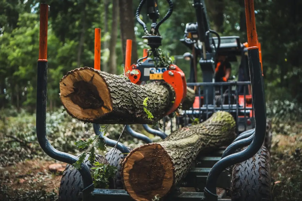
Connected forestry equipment, powered by sensors and the IoT, revolutionizes how we manage forests by making work more efficient and less hands-on. With these tools, managers can stay informed about what goes on in the forest without being there constantly. This transition results in reduced guesswork and smarter decisions every day. Shifting these devices to renewable power reduces waste, which makes the process more sustainable.
Sensor data is key for compliance with global sustainability regulations and securing green certifications. Businesses that need to demonstrate that they adhere to good practices require concrete data. IoT devices provide a constant flow of data and information, indicating whether logging areas are within permitted boundaries or if protected regions are untouched. This data assists firms in adhering to agendas that save jobs and the planet. For instance, remote sensors can monitor whether tree cutting occurs only in authorized plots, reinforcing standards like the Forest Stewardship Council (FSC) globally.
Waste from logging is huge. Because of poor data in the past, too many trees were felled or abandoned and sound timber wasted. Now, sensors monitor soil moisture, tree health and weather. Managers can determine when and where to cut, utilizing each log that is felled. Automated monitoring identifies areas with the greatest yield and highlights waste. More can be gained from every hectare with less impact on nature. In areas where blazes or infestations imperil crops, sensors issue alerts so response occurs before damage expands.
Sensors’ real-time alerts prevent overharvesting and preserve rare habitats of plants or animals. These notifications are sent when equipment enters risk areas or if there is excessive deforestation in a single location. If a sensor detects abrupt changes, such as reductions in soil moisture or indications of erosion, managers can halt activities and investigate. This immediate response supports the safety of threatened wildlife and maintains the integrity of the land for future generations. Remote sensing and satellite images provide an additional layer, allowing managers to get a bird’s eye view and track changes over time, from lost canopy cover to new growth.
Efficiency in forestry is measured by a few straightforward metrics. These numbers help managers see what works and what needs to change:
- Volume of timber harvested per hectare (m³/ha)
- Time taken from harvest to transport (hours or days)
- Amount of machine fuel used per hectare (liters/ha)
- Percentage of wood waste left on-site
- Number of incidents where sensitive areas are disturbed
- Speed of response to environmental changes (minutes or hours)
- Rate of biodiversity loss or gain in managed areas
Safety and operational impact
Connected sensors in logging equipment go a long way towards protecting crews and improving workflow. IoT technology redefines the way operators monitor machine health, detect anomalies, and react to hazards. These tools are not just about speed; they reduce risk, reduce downtime, and empower teams to accomplish more with less burnout.
Proximity sensors and collision avoidance systems are key for safety in the field. These sensors assist machines in “visioning” what’s nearby, such as humans, other machines, or unexpected obstacles. When a logger or loader pilots through dense brush or bumpy terrain, these sensors can detect what a human eye might overlook. They alert operators when a vehicle or worker gets too close. This reduces the risk of crashes, rollovers, or pinning incidents. Take, for instance, a hustling and bustling site where multiple equipment work in tandem. Such alerts can be the difference between a close call and an incident. Communication is crucial, particularly in remote regions where assistance from the outside world is a journey away. Thus, connected sensors serve as ever-vigilant eyes and ears.
Remote diagnostics and real-time alerts make quick work of fixing breakdowns. When a harvester or forwarder gets into trouble, sensors immediately alert the operator as well as the support crew. They can signal alerts for issues such as high engine heat, hydraulic leaks, or low oil pressure. With this early warning, teams can stop work, investigate what’s wrong, and repair it before a minor problem escalates. This rapid feedback keeps equipment running, reduces repair expenses, and keeps workers on schedule. For large-scale operations with a lot of equipment, real-time tracking enables managers to identify trends, schedule maintenance, and prevent expensive downtime.
The addition of IoT sensors to forestry equipment introduces a broad array of safety features that teams can leverage to train. Here is a checklist for training and daily checks:
- Proximity alerts: Warn operators about people, animals, or obstacles nearby.
- Collision avoidance: Auto-stop or slow equipment if a collision risk is detected.
- Remote diagnostics: Send alerts about engine, brake, or hydraulic problems.
- Maintenance reminders: Show when parts need to be checked or changed.
- Fatigue and distraction monitoring: Spot if an operator is tired or not paying attention.
- Emergency communication: Send distress signals or location data if something goes wrong.
- Environmental sensors: Track fire risks, weather shifts, or unstable ground.
- Load monitoring: Make sure machines do not carry more than they should.
- Geofencing: Set safe zones and send alerts if machines leave them.
Operators can leverage this list as a reference for safety briefings and training. It guides new and experienced operators to understand what capabilities are intrinsic, how to recognize problems, and how to deploy the technology effectively.
Integration challenges and solutions
There are a handful of practical integration challenges involved in bringing connected sensors to forestry machinery. Plenty of forestry operations still rely on legacy machines. These machines were not designed to be connected. When new sensor tech is introduced, it frequently fails to “speak” the same language as the existing in-the-field gear. This creates trouble when attempting to distribute data among various makes, models, and vintages of equipment. For instance, a new-age harvester equipped with smart sensors can monitor fuel consumption and machine health, but if its accompanying loader is an older model lacking data ports, it is difficult to obtain a comprehensive view of the operation. This is a common pain point in large-scale forestry, where fleets may contain both older and newer machines.
To address this, it’s useful to rely on common protocols for data exchange. As long as all components of the mixed fleet follow the same communications standards, information can flow seamlessly between machines. Protocols such as CAN bus or ISOBUS are prime examples. They allow sensors from one device to exchange data with another, even if the devices are from different manufacturers. Adopting a single standard simplifies future tech add-ons, so businesses don’t need to revamp their entire fleet all at once. This step is essential for worldwide operations, where hardware can be sourced from anywhere and technological enhancements must take a defined route.
Security comes into play. The more machines get connected, the greater the risk of cyberattacks. Forestry operations gather all sorts of sensitive data—from timber volumes to the precise route of each load. Without proper security, this data could be compromised or lost. To maintain the security of data, it’s wise to employ encrypted communications, secure authentication mechanisms, and regular software updates. Remote monitoring, such as transmitting machine data to a central office over a mesh network or by satellite, requires additional security layers. This holds even more when operators remotely control equipment. Mesh networks enable crews to monitor assets thousands of kilometers away—great for safety and efficiency, but only if the data link remains secure.
New sensor tech should be rolled out in phases. A phased plan means that not all of the machines are down at once for the upgrade, so the work continues to flow. Take for instance a business that begins with one fleet of harvesters, then adds sensors to loaders and haulers later on. In this manner, crews can become accustomed to the new systems incrementally, and support teams can identify issues sooner prior to expansion. With computing and sensor costs plummeting, more firms can take these steps without busting the budget. Satellite networks assist by powering connectivity to even the most remote sites, so real-time monitoring isn’t reliant on local cell towers.
Future trends and innovations
Forestry is racing into new tech. Connected equipment with sensors is at the center of these transformations. Machines and tools now collaborate with intelligent systems. These systems gather information, provide real-time response, and assist users in making decisions fast. The mission is to operate in forests with less damage, waste, and danger while increasing productivity and reducing expenses.
AI-powered analytics are transforming forest management. With machine learning and smart software built in, operators can identify hazards such as fire or disease early, before they propagate. These tools assist in predicting how much timber can be harvested, monitor tree growth, and even optimize routes for equipment. For instance, certain new systems are able to test soil health immediately and alert you of trouble spots. Thanks to these improvements, forest owners gain more control and can maintain their land’s health long-term. In certain areas, AI analytics assist in adhering to stringent guidelines regarding carbon capture and biodiversity, which is increasingly significant as climate targets become more challenging.
Drone-based sensors are proving really promising for mapping and health checks. Drones can buzz over massive or inaccessible locations and deliver back crisp photos. They give us images of where trees are sick, where pests are spreading, or where there are gaps in tree cover. In Brazil and Southeast Asia, drones assist in detecting illegal logging or monitor the growth rate of new trees. When drones collaborate with ground sensors, users receive a comprehensive view of forest vitality from canopy to root. This can save time and money compared to sending crews out on foot.
Wireless links and better batteries are enabling sensors in wild, remote forests. Ancient equipment used to break down miles distant from the road or plug. New models last longer and transmit through dense forests or over hills. That allows teams to place more sensors in more locations, including extreme environments. For small-time operators, this signifies they can hop on the bandwagon of data-informed decisions without massive initial expenditures. It assists in delivering smart forestry to new markets in Africa, Asia Pacific, and Latin America, where legacy tech frequently hindered end users.
Staying ahead is to keep up with new sensor tech as soon as it comes out. Some firms are now using blockchain to trace wood from forest to purchaser. This fosters trust and aids compliance with regulations for ethical and sustainable commerce. Electric and hybrid machines are on the rise, reducing noise and air pollution and making maintenance easier. Connected sensor-driven mechanized harvesting can increase yield by up to 40 percent and reduce damage to earth and animals. Public money and climate commitments in Europe and elsewhere are helping make these upgrades mainstream.