Understanding erosion risks in route planning
Mapping paths that minimize erosion and protect soil requires an intimate knowledge of the terrain. It’s not simply a matter of choosing the most direct route. It requires a thoughtful scan of slope, soil, water, and ancient trouble areas. Each can determine how much the soil will resist or wash away.
Begin by identifying high-risk erosion locations. Slope matters a lot. On steep slopes, water runs fast, ripping away soil with it. Flat ground decelerates water, but water can collect and create its own issues. Soil type is second. Sandy soil allows water to slip through fast, but clay traps water and can get slick. Loose soils wash away easily. Rocky or compacted soils tend to be more resilient, but they can crack or fracture under excessive use. Water flow contours the route all the more. Pay attention to what water does when it rains. Gullies, rills, or wet spots indicate where water is actively eroding the soil.
Try to get a sense for the underlying natural drainage before you select your route. Streams, brooks, and even dry gullies have to be labeled. If you can, don’t block or cross them. If a route must cross a drainage, select the narrowest point and design a small bridge or culvert to allow passage of water. This prevents water from pooling and eroding the soil downstream. Cutting through or filling in a drainage line forces water to change its course and accelerates erosion elsewhere.
Route choice should conform to the terrain. Use these steps to pick smarter paths:
- Reason about erosion risks in route planning. Follow the natural contour lines. Trails of this type that run across a slope (not straight up or down) both slow water and help hold soil in place. It’s safer to wind your way along a hillside than to slice a direct line up or down.
- Choose paths with minimal or gradual slopes. Steep slopes cause runoff to accelerate, which in turn wears deeper into the soil. Gentle slopes allow water to disperse and decelerate.
- Steer clear of wet or boggy patches. They’re easy to wreck and hard to repair. If you must cross, raise the track or employ elevated walkways.
- Stick to established stable surfaces. If you have an old track or road or hard-packed path that has held up well, try to use it rather than cut new ground.
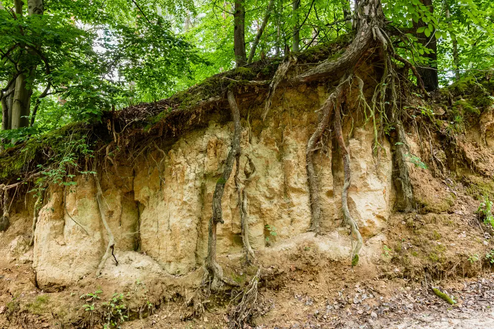
Looking at historical erosion helps. Once a spot has washed out, it will probably wash out again. Ancient pictures, local legend, or field indicators such as bare roots, deep ruts, or exposed rocks indicate where strife has struck in the past. Apply this knowledge to divert routes from trouble areas or schedule improved drainage and ground cover work there.
Integrating vegetation and ground cover solutions
Incorporating plant life and ground cover solutions to access routes can mitigate the process of erosion and retain soil. I love this solution which fits everywhere from city parks to farmland and building sites. Vegetation and ground cover solutions integrated into the design. Plants hold soil in place with their roots and absorb rainwater, so less soil is eroded. Selecting the appropriate combination of native grasses, shrubs, or trees bordering a path can have a significant impact. Deep-rooted plants such as vetiver grass are good on slopes, while shrubs or small trees can provide shade and make land more attractive. These plants aid water to soak into the ground, reducing runoff and keeping the soil damp.
Certain sections of a path will be exposed soil. These areas require additional attention as they are more susceptible to erosion, particularly during construction activities or adverse weather conditions. Whether it is mulch, straw, or wood chips, this can help cover the soil. This prevents rain from impacting the soil with intensity and protects it from erosive wind or water. For larger or steeper areas, geotextiles, which are special sheets of fabric or mesh, can be applied to the soil. These covers maintain soil in position until the plants begin to take hold. They hold up fine in areas with heavy foot or machinery traffic.
Buffer strips or vegetative barriers are key. These are bands of dense plants set along the edges of access routes. They catch soil and slow water as it flows off the path. By trapping sediment, they stop it from ending up in streams or drains. Buffer strips can be made from thick grasses, low shrubs, or even small trees. On flat ground, a strip one to two meters wide is often enough. On slopes or near water, wider strips may be better. These barriers help break up strong winds that might blow soil away.
The plants are selected based on the local soil and climate. Certain plants thrive in wet areas, and certain ones thrive in hot, dry areas. Native species are usually best as they require less water and maintenance. Here are a few examples that fit many climates:
- Tall fescue (cool, moist locations, retains soil with deep roots)
- Buffalo grass (dry, warm climates; tough and grows low)
- Vetiver grass is suitable for steep slopes, as it has powerful, deep roots that can pierce hard soil.
- White clover (tame, wet locales enriches the soil)
- Switchgrass (wide range of soils; good for heavy rain)
- Willow or poplar cuttings are suitable for wet soil, quick-rooting, and bank stabilization.
All of these steps work best when planned as part of the entire route layout. Placing plants and covers where they are needed most keeps soil from moving and protects the land for years to come.
Engineering sustainable access routes
Properly engineered access routes protect soil and minimize erosion, saving effort and expense in the long run. Human traffic patterns, surface composition, and gradient all contribute to the amount of soil lost. A trail that receives 1,000 dry-weather visits per month might not shed as much soil as one battered by 100 visitors over a rainy weekend, so accounting for water is as crucial as accounting for people.
Draining water off the route is crucial. Water bars, culverts, and cross-drains direct water away from vulnerable soil areas before it can erode ruts or wash soil down slope. Outsloping the tread, a gentle tilt of 3 to 5 percent, allows water to disperse in a thin sheet, carrying less soil with it. If water flows in a single channel, it can carve deep furrows quickly, particularly on steeper terrain. An inch of rain on a 10 percent grade can relocate tons of soil in the course of a mile. Whenever you can cut the slope even 1 percent, you save thousands in repairs later.
What you put on top counts, too. Hard surfaces such as concrete or asphalt prevent water from soaking into the ground, so runoff increases and erosion increases. When you use permeable options such as gravel, crushed stone, or even open pavers, it allows water to soak in and decelerate. These choices are particularly excellent for trails that traverse fields, parks, or other open areas where retaining water in the soil benefits vegetation.
Maintain routes as narrow and short as you can. For multi-use trails, a width of 6 to 10 feet (1.8 to 3 meters) provides sufficient separation for bikes, walkers, and strollers without making the path too broad. Grades under 10% are preferable, with 5% being best, as they slow water and ease passage. For hiking routes, a width of 3 to 4 feet (0.9 to 1.2 meters) works, and grades can go as high as 15% for short stretches. However, these will require more drains and should avoid running straight down slopes. Fall-line paths allow water to race and carve deep ruts.
Certain sections of a trail require additional durability, such as steep slopes or areas everyone traverses. Armoring these saves money down the road. It is better to spend $3,000 on geocell for a 100-foot trouble area than to rebuild a $500 path every year. Over 20 years, hard sections return in reduced effort and reduced repairs.
Recommended materials for reinforcing high-traffic or steep sections:
- Crushed stone or gravel (well-graded, compacted)
- Geocell or cellular confinement panels
- Open-grid pavers (plastic or concrete)
- Stabilized soil mixes (with natural binders)
- Recycled rubber mats or tiles
Leveraging technology and mapping tools
Digital tools have simplified the planning of access routes that reduce erosion and preserve soil health. These tools assist in mapping land, identifying vulnerabilities, and designing trails to work with the land, not against it.
GIS mapping is at the heart of almost all route planning nowadays. With GIS, users can overlay maps to examine slope, soil type, rainfall, and plant cover. This assists in indicating where soil is most susceptible, such as on bare ground or steep slopes. For instance, mapping can highlight badland regions or areas of sparse vegetation. With the USLE in GIS, they can predict where the soil will wash away fastest. This allows crews to plan routes that bypass these vulnerable areas or implement measures such as buffer strips if a route needs to go through. GIS comes in handy for monitoring erosion control effectiveness over time, such as after terracing or cover cropping has been implemented. Remote sensing, part of GIS, allows teams to monitor vegetation and soil status as shifts occur with seasons or storms. This can assist in identifying problems before they worsen.
Drone surveys have sped checking soil and plants on or near planned or constructed routes. Drones can fly low and capture sharp images illustrating soil cracks, water pooling, or areas where plants have receded. This enables teams to spot warning signs of erosion before bare soil develops into a gully. Drones can assist post-fires too, as burned land can erode rapidly with rain. They compare storm-damage images before and after so their crews can quickly patch up vulnerabilities.
Digital elevation models (DEM) employ drone or satellite data to create a 3D map of the terrain. DEMs aid in illustrating how water will flow off during rainfall. With these models, planners can identify locations where water will collect or flow quickly, which frequently results in ruts or washed out paths. With these flow paths in view, teams can move routes to higher ground or install drains and mini dams to slow down water. For instance, on hillside farmland, DEMs can assist in designing curved tracks that trace the shape of the land, preventing water from rushing directly downhill.
Mapping tools contribute to measuring uncertainty, because soil erodibility can vary even within one location. By placing data across multiple sources and periods, planners receive a clearer idea of exactly where risks are elevated. This simplifies the targeting of work and money to the most at-risk locations, wherever they may fall.
Below is a quick comparison of common mapping tools for erosion risk:
| Tool Type | Key Features | Example Uses | Data Source |
| GIS | Layering, analysis, prediction | Erosion mapping, route planning | Satellite, survey |
| Remote Sensing | Near real-time, plant cover | Watch change after storms or fires | Satellite, drone |
| Drone Imagery | Detail, rapid snapshots | Spot washouts, fine-scale mapping | Drone flight |
| Digital Elevation | 3D water flow, terrain | Drainage, slope, runoff mapping | Lidar, drone |
Engaging communities and local expertise
Empowering communities and local knowledge can assist in constructing more intelligent access roads that retain the earth and minimize destruction. Our local communities and experts contribute real-world experience from years of working, living, and caring for the region. These people observe the transformations in the soil, the water, and the plants, so they understand what succeeds and what collapses. By involving them up front, route planners can identify ancient trails, hidden marshes, or hillsides that wash out following a downpour. For instance, a farmer in a rural village may show them a shortcut trucks have taken for years, but explain how those wheels gouge deep ruts every spring. Paying attention to them can save time and money and prevent errors down the line.
Workshops or meetings allow all to discuss thoughts and concerns face-to-face or virtually. This step is key for trust building and for everyone feeling heard. Community walks can reveal the locations where access roads intersect with fields and streams or hills that are important to the community. They might request buffer strips of grass or easy drains cut into the side of a trail. In others, elders may remember floods or slips that transformed the land. When people talk together, it is simpler to evaluate tradeoffs such as gravel paths, wood chips, or raised boardwalks. If a design requires trails that can accommodate bikes or wheelchairs, the crew can discuss what suits best. Meeting notes and maps can keep track of all these talks and make sure nothing slips through!
Collaboration with communities and local knowledge can assist in getting erosion control set up and maintaining it for the long term. They usually have boots-on-the-ground experience with things like planting native grass to hold soil, installing water bars, or laying geo-mats on exposed earth. They know what grows best and how to detect vulnerabilities before they become bigger issues. In many areas, local communities have their own scouts and resources, so they can educate others or scan locations as seasons shift. For instance, a conservation group could spearhead a tree-planting day along a new path, demonstrating to locals how roots slow water and prevent washouts. These teams frequently connect with city planners, park rangers, or landowners and exchange updates to keep everyone on the same page.
It is important to record each issue, request, or recommendation from the community. Route designers should note down not only the major challenges, but the little advice, like the optimal time of year to construct or which slopes freeze first in the winter. These observations assist planners in tweaking the path, adding new amenities, or choosing optimal locations for culverts and crossings. Maintaining a transparent feedback record ensures that changes can be tracked and the final design pays tribute to all voices. This type of open record assistance builds trust and establishes a solid foundation for future projects.
Maintenance and adaptive management strategies
Roads and soil require ongoing attention if we are to maintain access. A solid plan isn’t sufficient. Proper maintenance and adaptive management can reduce soil erosion by as much as 90 percent on high-risk land. These strategies rely on real-time data, local knowledge, and a flexible approach. They depend on inspections, patching, tracking, and a solid to-do list. Both maintain durable outcomes and preserve trails safe for humans and nature.
Schedule regular inspections to detect and repair erosion damage along access routes promptly.
Annual inspections are important. They assist in identifying issues before they compound. Erosion can begin gradually, but soon it undermines routes and results in costly repairs. Walk the routes at least once per season or after heavy rain, searching for ruts, gullies, or loose soil. Fix little things immediately, such as filling in little washouts or replacing lost gravel. If a trail on a hillside begins to expose bare spots, incorporating mulch or cover crops can prevent additional erosion. In high foot or vehicle traffic areas, look for compacted soil, which aggravates runoff and erosion. Timely repairs are cost efficient and preserve safe rides.
Adjust maintenance practices seasonally to address changing weather and soil conditions.
Weather and soil don’t just remain consistent throughout the year. Rain, snow, drought, and storms each have their own dangers. Seasonal maintenance and adaptive management are important. In rainy months, inspect drainage ditches and culverts to ensure water is flowing where it should. If it’s dry, watch for dust or soil that blows away. Put down mulch, straw, or even temporary ground cover to hold the soil. Freeze-thaw cycles in cold climates can break up soil and compromise paths, so schedule additional inspections in the spring. Adapting your work to the season makes routes more sustainable and reduces damage.
Implement a monitoring system to track the effectiveness of erosion control measures over time.
A monitoring system provides real-time feedback on what works and what does not. Utilize straightforward tools such as soil moisture meters, erosion pins, or even photographs captured at fixed locations. Monitor changes in soil depth, plant cover, and runoff. This information indicates whether no-till, contour farming, or cover crops are effective. Review data every year or when land use changes. Tweak plans as necessary. If a cover crop is not growing well, for example, experiment with a different seed mix or planting time. Monitoring and adaptive management keep conservation efforts on track.
Create a checklist with comprehensive description to include routine maintenance tasks for long-term route sustainability.
A checklist makes certain that nothing gets overlooked. This includes inspecting for ruts, clearing drains, mulching, replanting cover crops, and repairing fences or signs. Note the frequency for each; some require weekly checks, others monthly or seasonal. Insert notes for local requirements, such as additional inspections post-storm. Use clear maintenance and adaptive management strategies with simple steps so anyone can follow the list, even if staff turns over. Revisit the list annually or following major alterations to the land or farm activities. This assistance with trail maintenance and adaptive management helps keep routes safe and soil sound in the long haul.
Regulatory compliance and environmental standards
Compliance and keeping up with environmental standards are key parts of planning access routes that minimize erosion and protect soil. These standards assist in maintaining soil stability, protecting water, and ensuring projects do not negatively impact the land. This approach does the right thing and builds trust, and it’s good earth care, too.
Reread all rules before commencing work. In most nations, regulations are imposed by both national and local organizations. For instance, in the U.S., the Environmental Protection Agency (EPA) ensures construction projects comply with the Clean Water Act. This law keeps soil and dirt from being dumped into our bodies of water, such as rivers, lakes, and streams. Similar regulations in other countries are frequently supported by rigorous monitoring of land clearance, construction, and maintenance. In most locations, you will have to consult with local and national agencies to determine which regulations apply in your region. Ignorance of these rules can result in fines or a stop work order.
Permits are next. First, before constructing any access routes, obtain all necessary permits. These may include soil and water safeguards, waste management, and land use. Skipping this step can mean legal trouble or delays. If your line crosses rivers or wetlands, you will probably need special permits to safeguard those areas. For big projects, you may need to submit plans to local organizations or the public, making the process more transparent and equitable.
Best management practices (BMPs) are measures you have to implement to prevent soil erosion and contamination. For the most part, they will require a Stormwater Pollution Prevention Plan (SWPPP). This plan details measures such as silt fences, mulch, or water bars to impede water and prevent soil from washing off. In most countries, these are not simply recommended; they are mandatory. Good BMPs imply keeping areas free of equipment when not required, stabilizing bare soil with grass or mulch, and phasing work to reduce how much land is open at one time. Phasing, or breaking work into smaller increments, allows the land to rest between phases, which reduces erosion risk.
Here’s a summary of key regulatory standards that often apply:
| Standard/Practice | What it Covers | Who Enforces It |
| Clean Water Act (U.S.) | Water quality, erosion, sediment control | EPA, State Agencies |
| Stormwater Pollution Prevention Plan | BMPs for erosion and sediment control | Local/National Agencies |
| Sediment Control Rules | Keep dirt out of water, habitat care | Local/Regional Gov’t |
| Phasic Construction | Less land open at once, faster recovery | Building Authorities |
Abiding by them does more than keep you legit. It safeguards water, land, and life surrounding your site. With these measures, you reduce issues such as turbid water, erosion, and habitat destruction. Erosion control is not just about catching dirt; it is about saving clean water, healthy soil, and secure habitats for flora and fauna.